ALMA Project Book, Chapter 14

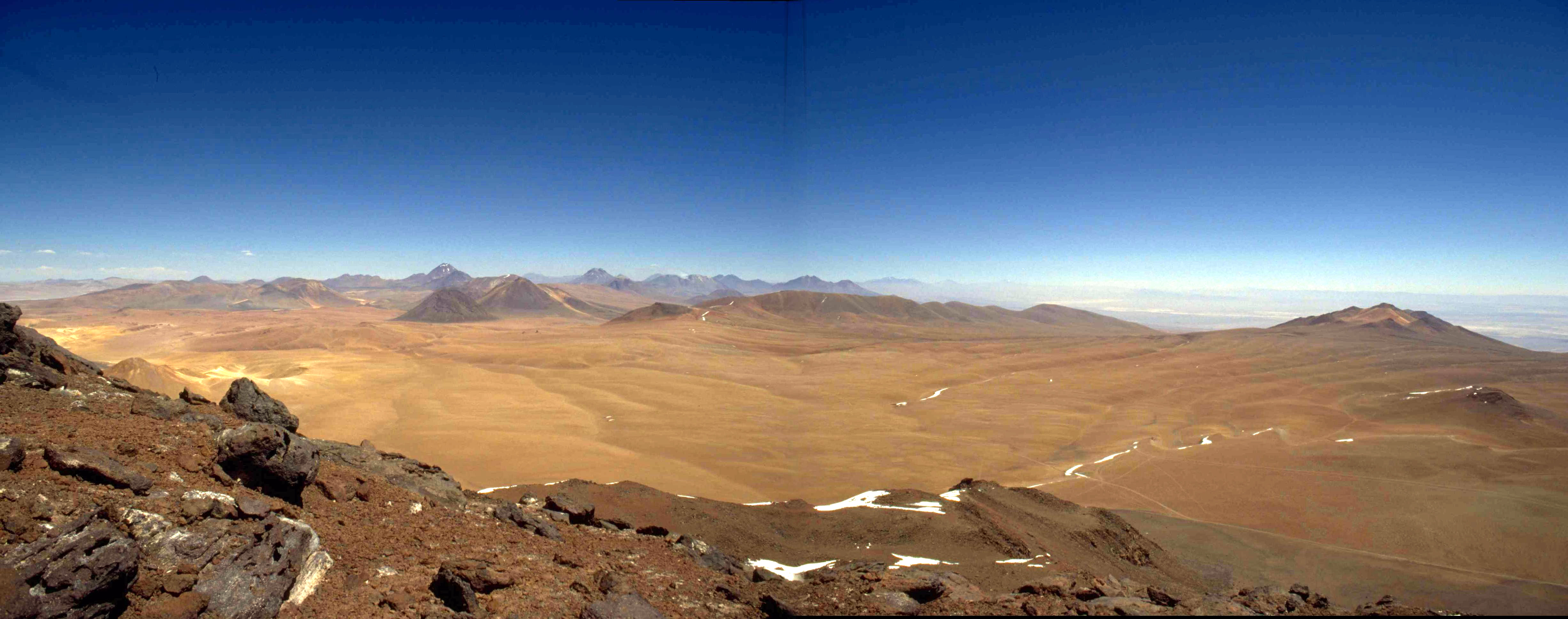
View south from Cerro Chajnantor of MMA site.
Photo: S. Radford, 1994 November.
Revision History:
2000 September 6: Updated, removed WBS numbers.
1999 February 4: Updated URLs.
1998 October 16: Reorganized to match WBS,
added section numbers.
1998 July 15: Original version.
14.1 Goals
During the project's prehistory, NRAO conducted extensive measurements
to characterize several candidate sites for the Millimeter Array. These
studies culminated in the
recommendation
of an array site on the high (5000 m) plateau southwest of Cerro Chajnantor,
Chile,
about 40 km east of the village of San
Pedro de Atacama. The goals of further site characterization and monitoring
are:
-
to identify and quantify site conditions and their influence the instrument
design or operations concepts,
-
to provide a historical record of site conditions to guide priorities for
instrument development and operation,
-
to maintain a continuous presence on the site through development and construction
to the start of operations, and
-
to maintain contact and coordinate efforts with other groups working on
or near the site.
14.2 Areas of interest
At millimeter and submillimeter wavelengths, pressure broadened molecular
spectral lines make the atmosphere a natural limitation to the sensitivity
and resolution of astronomical observations. Tropospheric water vapor is
the principal culprit. The translucent atmosphere both decreases the signal,
by attenuating incoming radiation, and increases the noise, by radiating
thermally. Furthermore, inhomogeneities in the water vapor distribution
cause variations in the electrical path length through the atmosphere.
These variations result in phase errors that degrade the sensitivity and
resolution of images made with both interferometers and filled aperture
telescopes. The site characterization effort addresses these areas:
-
Radiometric properties of the atmosphere
-
Physical structure of the atmosphere
-
meteorology
-
stratification
-
turbulence
-
Physical characteristics of the site
14.3 Site Infrastructure
The ALMA operations base on Chajnantor are two 20 foot (6 m) long ocean shipping
containers. These provides shelter for personnel and physical support for
the instruments. In 1995, NRAO installed the first container and in
1998 June ESO installed a second container 15 m north of
the NRAO equipment.
In 1998 October, a third container was installed 1 km west of the ALMA
containers as a launch base for radiosondes.
14.3.1 Safety program
Site inspections (every six months? year?); inventory, inspection, and,
if necessary, repair or replacement of safety supplies and equipment; identification,
and, if necessary, remediation of safety hazards; training (first aid,
high altitude illness, oxygen therapy, fire safety, industrial safety).
Note NRAO safety rules.
14.3.2 Solar power system
All three containers have arrays of solar panels and battery banks to
supply electrical power. The system on the NRAO container can supply
about 500 W continuously (24 VDC and 110 VAC 60 Hz),
with sufficient reserve capacity to weather a storm of a few days.
With current instrumentation, this system operates near capacity.
The ESO container has a slightly smaller system
(24 VDC and 220 VAC 50 Hz), also near capacity.
A wind turbine has been installed on two occasions to augment the NRAO
system, but it broke quickly.
System maintenance includes a periodic (yearly) check and
refill of battery water.
14.3.3 Communications
Voice and low-speed (<= 9600 baud) data are transmitted by cellular
and satellite (Inmarsat A) telephones.
In 2000 October, an Inmarsat M4 satellite terminal will be deployed
to provide voice and ISDN (64 kbaud) data communications.
The Inmarsat A terminal then will be decommissioned.
Handheld radios will be used for
communications on and around the site.
14.3.4 Transportation
Four wheel drive vehicles are required to access to Chajnantor, especially
during inclement weather.
14.3.5 High resolution digital elevation model
1n 1996, contour maps and digital elevation models were prepared from aerial
photographs
(Maps
of the Chajnantor Zone). These cover two 8 × 8 km regions of
the Chajnantor
and Pampa la Bola areas at 5-10 m resolution. In 1999, these maps were extended
to the entire science reserve (18 × 19 km). They will be used for
hydrodynamic studies of airflow over the site, for planning the array configurations,
and for planning civil works.
14.3.6 Computers and network
All NRAO and ESO instruments are controlled by PCs running Windows 95. They are
interlinked with ethernet, which extends to the LSA container. The PC clocks
are synchronized to a GPS receiver that provides an absolute time reference
good to about 1 s. The GPS receiver was used to determine the position of the
container (Memos
261 and
312)>
14.3.7 Auxiliary instruments
-
A surveillance camera,
installed on 1997 June 15, takes pictures
of the southwest horizon every two hours. Data are retrieved about
once a month and the images
posted.
-
A subsurface temperature probe was operated 1997 June - October and 1998
March - May. Data are analyzed in Memo 314.
-
A seismometer was installed in 1995. Data are analyzed by Chilean group
(K. Bataille). Firmware was updated in 2000 July to accomodate GPS date rollover.
14.3.8 Physiology studies
John West, MD (UCSD) is investigating strategies for improving worker comfort
and performance at high altitude. These include enhancing the oxygen concentration
of the air in working and living quarters (Memos
191 and
302).
14.4 Atmospheric stability
Inhomogeneities in the distribution of water vapor cause variations in
the electrical path length through the atmosphere. The resulting phase
errors degrade the sensitivity and resolution of observations with both
interferometers and filled aperture telescopes.
The site test interferometers directly measure the tropospheric phase stability.
They observe unmodulated 11.5 GHz beacons broadcast from geostationary
satellites and measure the phase difference between the signals received
by two 1.8 m diameter antennas 300 m apart. Because the atmosphere is non-dispersive
away from line centers, the results can be scaled to millimeter and submillimeter
wavelengths.
Four instruments have been constructed by NRAO's Tucson office. The
first was operated near the VLBA antenna (3720 m) on Mauna Kea, Hawaii,
from 1994 September to 1996 June, then installed at the
VLA in in 1997 May. The second has been operating on Chajnantor (5000 m) near San Pedro
de Atacama, Chile, since 1995 May. A third was built for the LSA project.
ESO installed it at Pajonales in 1997 April and moved it to Chajnantor
in 1998 June.
A fourth instrument, with a 100 m baseline, was installed at Green Bank in 2000 March.
The design and operation of these instruments are described in
Site
Test Interferometer (Radford, Reiland, & Shillue 1996, PASP 108,
441). From the phase time series, we obtain the r. m. s. path fluctuations
on a 300 m baseline, the power law exponent of the phase structure function,
and the velocity at which the turbulent water vapor moves over the array.
Memo 129
describes the site test interferometer data reduction in detail,
and Memo 130
illustrates the agreement between two different methods of
deriving the mean velocity of the turbulent water vapor flow in the atmosphere.
In 1998 June, the ESO interferometer was set up alongside the NRAO interferometer.
They share essentially the same baseline, but observe different satellites
about 5° apart on the sky. Lag correlation of the data from the two
interferometers will indicate the height of the turbulent layer (see
Memo 196).
The interferometers operate autonomously. Status reports are received
daily and data are retrieved about once a month. The data are analyzed
in Tucson and monthly
summaries
are posted. Current activity includes operation and maintenance, including
sporadic repair as required, data retrieval, and data analysis.
14.5 Atmospheric transparency
Pressure broadened molecular spectral lines, principally of tropospheric
water vapor, make the atmosphere semi-opaque at millimeter and submillimeter
wavelengths. The translucent atmosphere radiates thermally, which increases
the system noise, and attenuates incoming radiation, which decreases the
signal.
The 225 GHz tipping radiometer is the benchmark instrument for site characterization.
It measures the atmospheric transparency every 10 minutes and the stability
of atmospheric emission every fifth hour. Operation is automatic. Daily
and monthly
data summaries are posted. The data are made available to interested parties
in machine readable form. Current activity includes operation and maintenance,
including sporadic repair as required, data retrieval, and data analysis.
A tipping photometer was been developed in collaboration with Carnegie
Mellon University to directly measure the atmospheric transparency at 350
µm wavelength. This instrument is based on an ambient temperature,
pyroelectric detector. The spectral response is defined by a resonant metal
mesh. A compound parabolic (Winston) cone and offset parabolic scanning
mirror together define the 6° beam on the sky. The detector is internally
calibrated with two temperature controlled loads and views the sky through
a woven Gore-tex window. Identical instruments have been deployed on Chajnantor
(1997 October), at the CSO on Mauna Kea (1997 December), and at the South
Pole (1998 January).
An incomplete fourth unit was supplied to the University of New South Wales
in 1999 July for modification prior to remote Antarctic deployment.
In 2000 June, a fifth instrument equipped with a filter wheel and 200,
260, 350, and 1300 µm filters was deployed at Chajnantor. In 2000
October, this will be redeployed to 5700 m on Sairecabur to investigate the dependence
of transparency with altitude in the area of Chajnantor.
The instruments operate autonomously. Status reports are received daily
and data are retrieved about once a month. The data from these instruments
are being analyzed with the aim of making an unbiased comparison of the
three sites. Current activity includes operation and maintenance, including
sporadic repair as required, data retrieval, and data analysis. Further
work includes
cross calibration between the submm tipper and other instruments, namely
the 225 GHz tippers, SCUBA, CSO, and AST/RO,
14.5.2 Fourier Transform Spectrometer
To measure the atmospheric emission spectrum at Chajnantor, the Smithsonian
Observatory has deployed a Fourier transform (polarizing Martin-Pupplet)
spectrometer. This cryogenic instrument covers 350 - 3000 GHz with 3 GHz
resolution and a 3° beam. The instrument recorded data for most of
the 1998 winter season. NRAO provides the base for field operations.
14.6 Physical structure of atmosphere
The vertical profiles of atmospheric water vapor and turbulence may affect
the success of radiometric phase calibration schemes.
Radiosondes carried by weather balloons provide in situ measurements
of pressure, temperature, humidity, and wind speed and direction over the
launch site. From these data we learn about the stratification of the
water vapor over Chajnantor and about shear layers that may generate turbulence.
A surplus radiotheodolite was acquired, upgraded by the manufacturer, tested
in Tucson, and deployed at Chajnantor. Beginning in 1998 October, balloon
flights have been made whenever appropriate personnel are at the site.
This campaign is a collaboration between NRAO, Cornell, ESO, and SAO. The
balloons are launched from a container placed 1 km west of the main
site.
14.6.2 Hydrodynamic models
Calculations of airflow over Chajnantor, with emphasis on turbulence generated
by local topography. Collaboration with NOAO.
14.6.3 Sodar
Acoustic sounding, or sodar, senses thermal turbulence in the lower atmosphere.
Engineering tests of an ESO sodar unit were made in 1999 November.
We are evaluating our interest we have
in pursuing further measurements.
14.6.3 Weather stations
Additional weather stations will be deployed to measure the variation of
meteorological parameters over the site.
14.7 Technical planning with collaborators and neighbors
Several groups are carrying out site characterization studies or astronomical
experiments nearby. NRAO encourages these groups and takes interest in
their results. As needed, NRAO and the other groups coordinate activities.
14.7.1 ESO
In 1998 June, ESO redeployed its site characterization equipment
to Chajnantor. The ESO equipment, located 15 m north of the NRAO equipment,
includes:
-
Several weather stations. These are currently deployed adjacent to the
containers, but will be deployed across the site in the last quarter of
1998.
-
A 12 GHz interferometer. This is set up alongside the NRAO interferometer,
sharing essentially the same baseline, but observing different satellites
about 5° apart on the sky. Lag correlation of the data from the two
interferometers will indicate the height of the turbulent layer (see MMA
Memo 196).
-
Dual three channel 183 GHz radiometers. These
(instruments,
designed and
constructed by MRAO, OSO, and ESO, measure the H2O line shape.
They are installed at the ends of the LSA interferometer and look in the
same direction as the interferometer. Variations in the line shape will
then be compared to the phase fluctuations measured with the interferometers.
See Memo 271.
-
A single channel 22 GHz radiometer (deployment uncertain).
ESO provides field support for the ALMA site characterization
program.
At Pampa la Bola, about 7 km northeast of the MMA equipment, the LMSA project
has installed:
-
Weather stations
(Memo 322),
-
Dual 220 GHz tipping radiometers,
-
A 12 GHz interferometer, and
-
A Fourier Transform Spectrometer (temporary deployments).
The CAT project is making optical seeing (DIMM) measurements. Campaigns
in 1998 May, July, October, etc.
14.7.3 MAT
Observations of fluctuations in the Cosmic Background Radiation by a Princeton/Pennsylvania
group. Campaigns in 1997 and 1998.
14.7.3 CBI
Observations of fluctuations in the Cosmic Background Radiation by a Caltech
group. Deployment occurred in late 1999, with observations throughout 2000.
14.8 Site Characterization Reviews
Scientific reviews of site characterization data obtained by all groups.
14.8.1 USNC/URSI meeting
At the USNC/URSI National Radio
Science Meetingin 1999 January in Boulder, there was be a session
on Atmospheric Transmission
at Millimeter and Submillimeter Wavelengths. Results from the NRAO
site characterization program will be presented.
14.8.2 Mid-term Review
2000 March 22
14.8.3 Final Review
2001 March
References
ALMA Site Studies at NRAO
ALMA Site Studies at ESO
MMA site NRAO safety
rules
NRAO 1998 May,
Recommended
Site for the Millimeter Array [also
ps]
Delgado, G., Otárola, A., Belitsky, V., & Urbain, D.,
The
Determination of Precipitable Water Vapour at Llano de Chajnantor from
Observations of the 183 GHz Water Line, MMA Memo 271
Gerard, A. B., McElroy, M. K., Taylor, M. J.,Grant, I., Powell, F. L., Holverda, S.,
Sentse, N., &West, J. B., 2000,
Six
Percent Oxygen Enrichment of Room Air at Simulated 5000 m Altitude Improves
Neuropsychological Function, High Altitude Medicine & Biology 1, 51; ALMA Memo 302
Holdaway, M. A., & Radford, S. J. E., 1998, Options
for Placement of a Second Site Test Interferometer on Chajnantor, MMA
Memo 196
Holdaway, M. A., Gordon, M. A., Foster, S. M., Schwab, F. R.,
and Bustos, H., 1996, Digital
Elevation Models for the Chajnantor Site, MMA Memo 160
Holdaway, M. A., 1995, Velocity
of Winds Aloft from Site Test Interferometer Data, MMA Memo 130
Holdaway, M. A., Radford, S. J. E., Owen, F. N., & Foster, S. M.,
1995, Data
Processing for Site Test Interferometers, MMA Memo 129
Radford, S. J. E., Reiland, G., & Shillue, B., 1996, Site
Test Interferometer, PASP 108, 441
Radford, S. J. E., 1999, Position of MMA Equipment on Chajnantor, MMA Memo 261
Radford, S. J. E., 2000, Refined Position of ALMA Equipment on Chajnantor, ALMA Memo 312
Sakamoto, S., Handa, K., Kohno, K., Nakai, N., Otárola, A., Radford, S. J. E., Butler, B.,
& Bronfman, L., 2000, Comparison
of Meteorological Data at the Pampa La Bola and Llano de Chajnantor Sites, ALMA Memo 322
Snyder, L. A., Radford, S. J. E., & Holdaway, M. A., 2000, Underground
Temperature Fluctuations and Water Drainage at Chajnantor, ALMA Memo 314
West, J. B., Powell, F. L., Luks, A. M., 1997, Feasibility
Study of the Use of the White Mountain Research Station (WMRS) Laboratory
to Measure the Effects of 27% Oxygen Enrichment at 5000 m Altitude on Human
Cognitive Function, MMA Memo 191